
Description
Navionics Platinum+™ – NPEU645L | microSD™/SD™
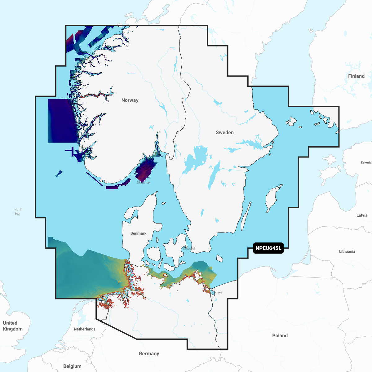
Detailed coverage of the Skagerrak and Kattegat and the approaches to them. Coverage includes the Scandinavian coast from Kristiansund, Norway to Gavle, Sweden; the Aland Islands; Turku, Finland; Gotland and Bornholm Islands; the Szczecin Lagoon; the Kiel Canal and all of Denmark. Ports include Oslo, Norway; Malmo and Stockholm, Sweden; Copenhagen and Aarhus, Denmark and Hamburg, Germany. Lakes include but are not limited to Lakes Vänern, Vättern, Mjörn, Sommen and Uddjuar in Sweden and Lakes Mjøsa, Bandak, Flåvatn, Norsjø and the Telemark Canal in Norway.
INTEGRATED MAPPING FOR A WIDE RANGE OF CHARTPLOTTERS
A comprehensive, all-in-one solution, Navionics+ charts and maps combine clear, reliable coastal/inland content with advanced guidance features and compatibility with a wide range of chartplotter brands.