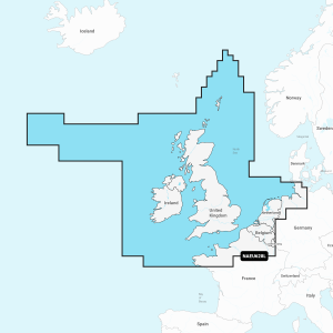
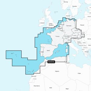
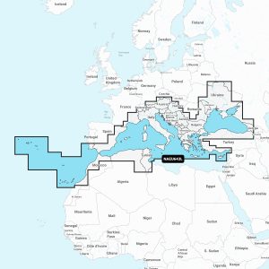
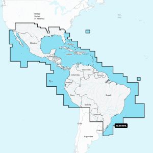
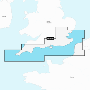
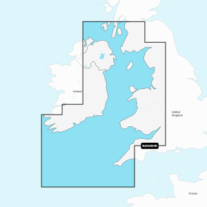
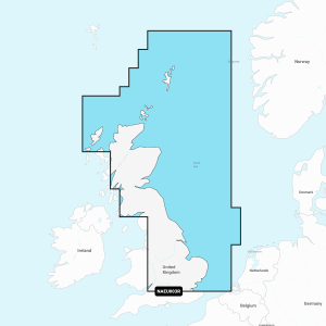
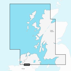
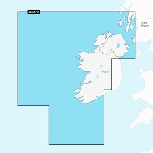
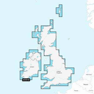
Navionics+ cartography provides integrated offshore and inland marine mapping content with rivers, bays and more than 42,000 lakes around the world. This all-in-one solution offers clear, reliable cartography for the widest range of chartplotter brands.
NAVIONICS CHART FEATURES
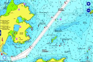
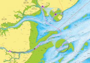
NAUTICAL CHART – go boating with comprehensive charts derived from multiple official, government and private sources, displayed in a familiar look and feel.
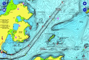
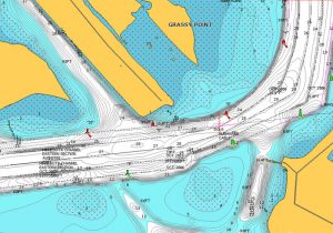
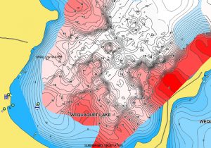
SONARCHART™ – understand depths and bottom detail with our innovative 1ft/0.5 m bathymetry charts created using Navionics proprietary systems that process sonar data contributed by boaters with existing content
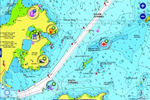
COMMUNITY EDITS – get useful local knowledge from fellow boaters in this crowdsourced content layer packed with points of interest, navigation aids and variety of edits made by users of our boating app.
NAVIONICS ADVANCED FEATURES
Plotter Sync – allows compatible chartplotter owners to transfer routes and markers, update chart layers and more — to and from the Boating app.
Dock to Dock Route Guidance – choose your destination by selecting a point of interest, entering a lat/long or by tapping on the map. Dock-to-dock Autorouting calculates a suggested route.
Advanced Map Options – change the way you view Navionics charts and focus on the details that matter most to you. Highlight shallow areas, adjust contour density & select a fishing range.
SonarChart Live – watch new 0,5 m personal HD bathymetry maps develop in real time as your boat moves along the water! It appears as an additional layer over your map, while it also gets stored on your device for future use.
A simple and cost effective card created for owners of old or expired cards, the Navionics+ Updates GPS plotter card allows boaters to download the most up-to-date Navionics+ chart content via the Chart Installer. It is activated using an eligible card from Navionics or one from another brand, such as C-MAP, Lowrance, or Lighthouse.
Other options available only via the Chart Installer. If unsure, call us for further guidance.