BlueChart® g3 and BlueChart g3 Vision mapping products with integrated Garmin and Navionics content are still available for Garmin chartplotters that are not compatible with newer Garmin Navionics+ chart format.
Features
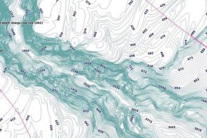
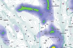
Up to 1' contours
Up to 1' contours provide a detailed and clear view of bottom structure floor for improved fishing charts and enhanced detail in lakes, canals and port plans.
Included in BlueChart g3 and BlueChart g3 Vision
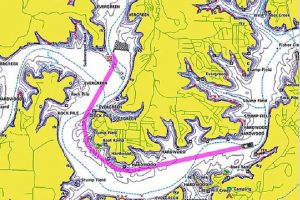
Auto Guidence
Auto Guidance technology allows you to easily calculate routes and see a suggested path to follow.
Included in BlueChart g3 and BlueChart g3 Vision
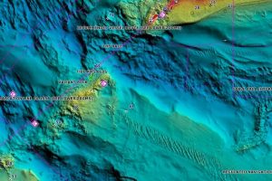
Relief Shading
Highly detailed shading that combines colour and shadow to provide an easy-to-interpret, clearer view of bottom structure than contour lines alone.
Included in BlueChart g3 Vision via download from the ActiveCaptain® App
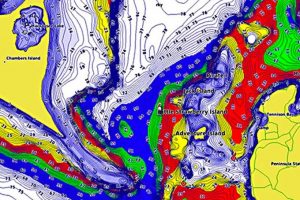
Depth-Range Shading
High-resolution depth range shading for up to 10 depth ranges so you can view your designated target depth.
Included in BlueChart g3 and BlueChart g3 Vision
Shallow-Water Shading
To give a clear picture of shallow waters to avoid, this feature allows for shading at a user-defined depth.
Included in BlueChart g3 and BlueChart g3 Vision
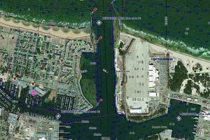
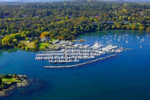
High-Resolution Satellite Imagery
High-resolution satellite imagery provides superior situational awareness.
Included in BlueChart g3 Vision
Aerial Photography
Crystal-clear aerial photography shows exceptional detail of many ports, harbours and marinas and is ideal when entering unfamiliar ports. Included in BlueChart g3 Vision
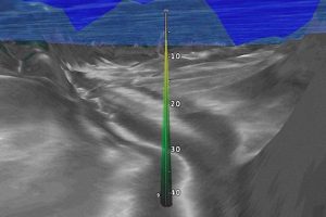
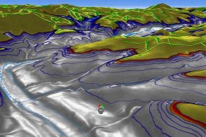
3D FishEye View
This underwater perspective shows 3D representation of bottom and contours as seen from below the waterline. Interface with sonar data for a customized view.
Included in BlueChart g3 Vision
3D MarinerEye View
This view provides a 3D representation of the surrounding area both above and below the waterline.
Included in BlueChart g3 Vision
Update/Upgrade your BlueChart® g3 & g3 Vision charts
Chart updates provide important information regarding changes to the shorelines and water depths, or where new on-water navigation aids — like beacons and buoys — might have cropped up since you last took your boat out. These are just a few examples of the changes that may be camouflaged on an outdated marine chart. While there are several unforeseen events that could affect your navigation, don’t let an out-of-date marine chart be one of them – To find out more about how to update your chart contact and we will be happy to advise.