
Description
Navionics®+ – NASA004L | microSD™/SD™
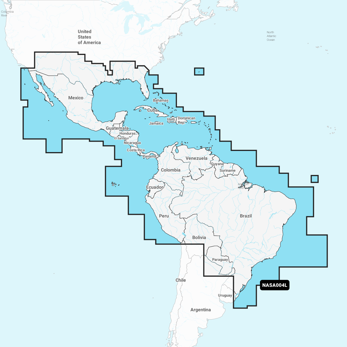
Coastal coverage of Mexico, Central America and Brazil. Coverage includes the US Gulf Coast and the eastern US coast to Savannah, GA; Bermuda; the Bahamas; Cuba; Hispaniola; Puerto Rico and the Virgin Islands; the Windward and Leeward Islands; Jamaica; the Panama Canal, the western coast of South America to Arica, Chile; the Galapagos Islands; the Revillagigedo Islands; the Ilha Fernando de Noronha; the Saint Peter and Saint Paul Archipelago and the Rocas Atoll.
INTEGRATED MAPPING FOR A WIDE RANGE OF CHARTPLOTTERS
A comprehensive, all-in-one solution, Navionics+ charts and maps combine clear, reliable coastal/inland content with advanced guidance features and compatibility with a wide range of chartplotter brands.
![]()
Navigate with our best offshore and inland lake coverage for your compatible chartplotter1.
![]()
See it your way. Customise your view with various chart layers and overlay combinations.
![]()
With your included 1-year subscription, access daily updates via the Navionics® chart installer software.
![]()
Advanced route guidance technology2 lets you navigate with suggested dock-to-dock routings.
![]()
Selectable map options let you highlight shallow areas, adjust contour density or select a fishing range.
![]()
Save money — while continuing to access daily updates plus new content downloads — by renewing your subscription