
Description
Navionics®+ – NAEU643L | microSD™/SD™
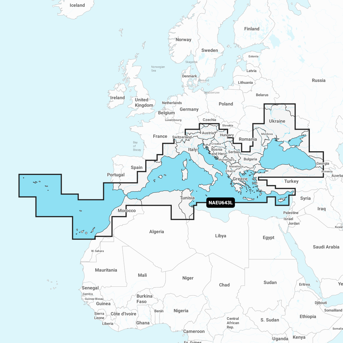
Detailed coverage of the Mediterranean and Black Seas. Coverage includes the Azores, Madeira, the Canary Islands, Gibraltar, the Balearic Islands, Corsica, Sardinia, Sicily, Malta, Crete, Cyprus, the Dardanelles, the Bosporos, the Sea of Azov, the Dneiper River to the Kyivs’ke Reservoir, the Danube River to Passau, Germany, Lake Balaton, Lake Garda, Lake Como and Lake Maggiore. Ports include Cadiz and Barcelona, Spain; Monaco; Marseille and Toulon, France; Genoa, Naples, Taranto and Venice, Italy; Istanbul, Türkiye; Odessa, Ukraine; Tunis, Tunisia and Algiers, Algeria.
INTEGRATED MAPPING FOR A WIDE RANGE OF CHARTPLOTTERS
A comprehensive, all-in-one solution, Navionics+ charts and maps combine clear, reliable coastal/inland content with advanced guidance features and compatibility with a wide range of chartplotter brands.