
Description
Navionics®+ – NAEU060R | microSD™/SD™
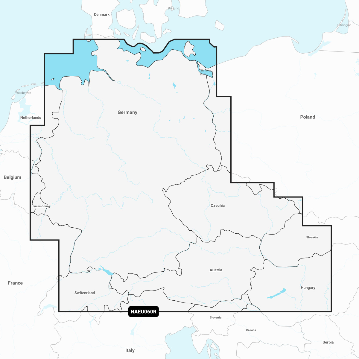
Detailed coverage of the German North Sea and Baltic coast, the German inland waterway system and numerous lakes. Coverage includes the entirety of the Rhine River, the Main River to Bamberg, the Danube River to Budapest, the Saar River, the Moselle River to Metz, France; the Ems River, the Weser River, the Elbe River to Chvaletice, Czech Republic, the Vltava River to Trebenice, Czech Republic, the Havel River, the entirety of the Rhine-Main-Danube Canal, the Oder-Havel Canal, the Elbe-Havel Canal, the Elbe-Seiten Canal, the Müritz, the Kiel/Lübeck/Flensburg Canal, the Mittelland Canal, Lake Constance, Lake Zurich, Lake Balaton and numerous other lakes including the Chiemsee, Attersee and Neusiedler See.
INTEGRATED MAPPING FOR A WIDE RANGE OF CHARTPLOTTERS
A comprehensive, all-in-one solution, Navionics+ charts and maps combine clear, reliable coastal/inland content with advanced guidance features and compatibility with a wide range of chartplotter brands.
Navigate with our best offshore and inland lake coverage for your compatible chartplotter1.
See it your way. Customise your view with various chart layers and overlay combinations.
With your included 1-year subscription, access daily updates via the Navionics® chart installer software.
Advanced route guidance technology2 lets you navigate with suggested dock-to-dock routings.
Selectable map options let you highlight shallow areas, adjust contour density or select a fishing range.
Save money — while continuing to access daily updates plus new content downloads — by renewing your subscription