
Description
Navionics®+ – NAEU074R | microSD™/SD™
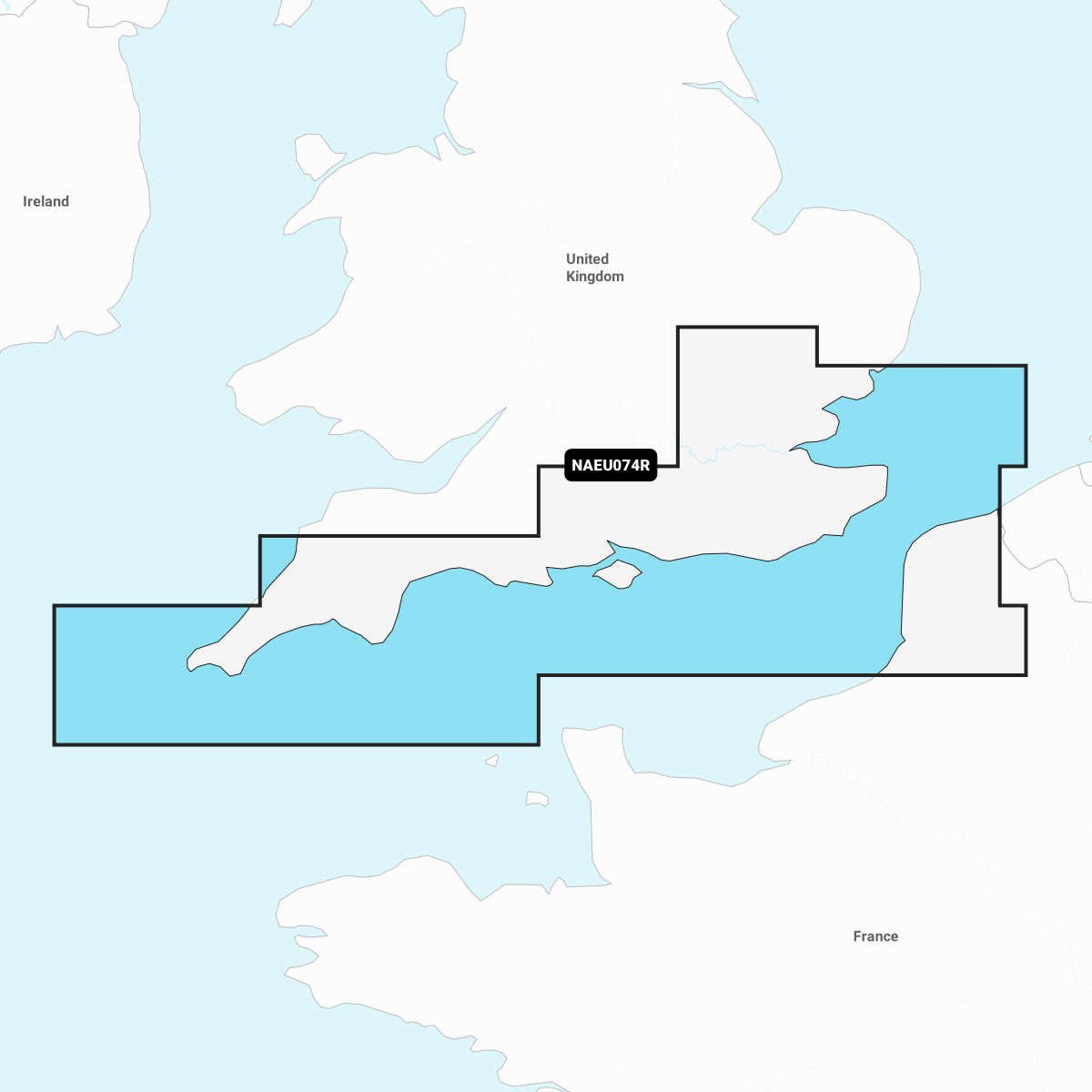
Detailed coverage of the south coast of the UK from Felixstowe to the Isles of Scilly and the coast of France from Dunkirk to Le Treport. Coverage includes the River Thames to Windsor, the Isle of Wight and the ports of London, Dover, Portsmouth, Southampton and Plymouth in the UK and Calais, France.
INTEGRATED MAPPING FOR A WIDE RANGE OF CHARTPLOTTERS
A comprehensive, all-in-one solution, Navionics+ charts and maps combine clear, reliable coastal/inland content with advanced guidance features and compatibility with a wide range of chartplotter brands.