
Description
Navionics®+ – NASA010R | microSD™/SD™
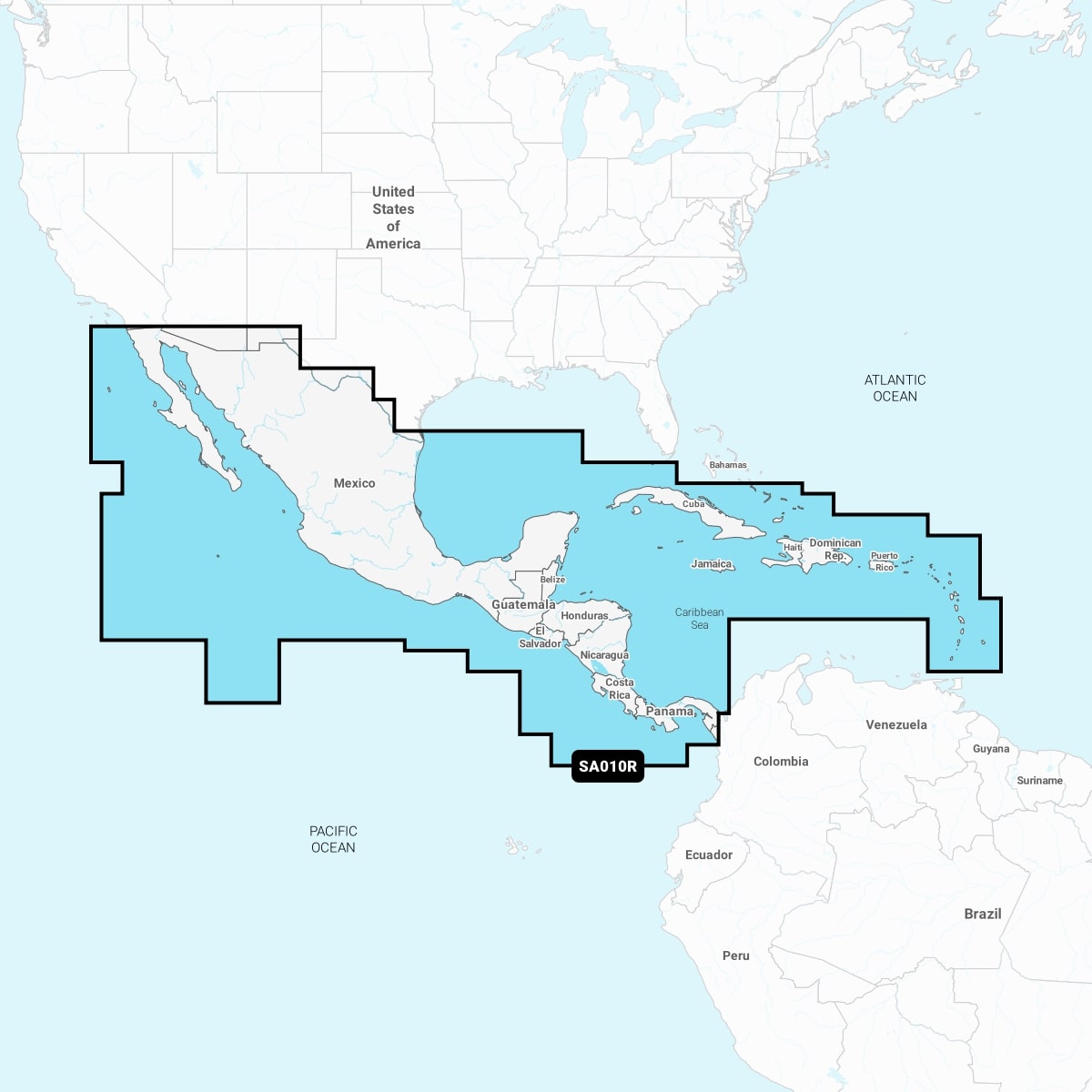
Detailed coverage of the west coast of Mexico from Tijuana to Panama. Including the Panama Canal in its entirety. East coast coverage from Panama to Brownsville, TX. Also includes detailed Caribbean coverage of the Far Bahamas, Turks & Caicos, Cuba, Jamaica, the Caymans, Haiti, Dominican Republic, Puerto Rico and the Lesser Antilles To Grenada.
INTEGRATED MAPPING FOR A WIDE RANGE OF CHARTPLOTTERS
A comprehensive, all-in-one solution, Navionics+ charts and maps combine clear, reliable coastal/inland content with advanced guidance features and compatibility with a wide range of chartplotter brands.
![]()
Navigate with our best offshore and inland lake coverage for your compatible chartplotter1.
![]()
See it your way. Customise your view with various chart layers and overlay combinations.
![]()
With your included 1-year subscription, access daily updates via the Navionics® chart installer software.
![]()
Advanced route guidance technology2 lets you navigate with suggested dock-to-dock routings.
![]()
Selectable map options let you highlight shallow areas, adjust contour density or select a fishing range.
![]()
Save money — while continuing to access daily updates plus new content downloads — by renewing your subscription3.