
Description
Garmin Navionics+™ – NSEU063R | microSD™/SD™
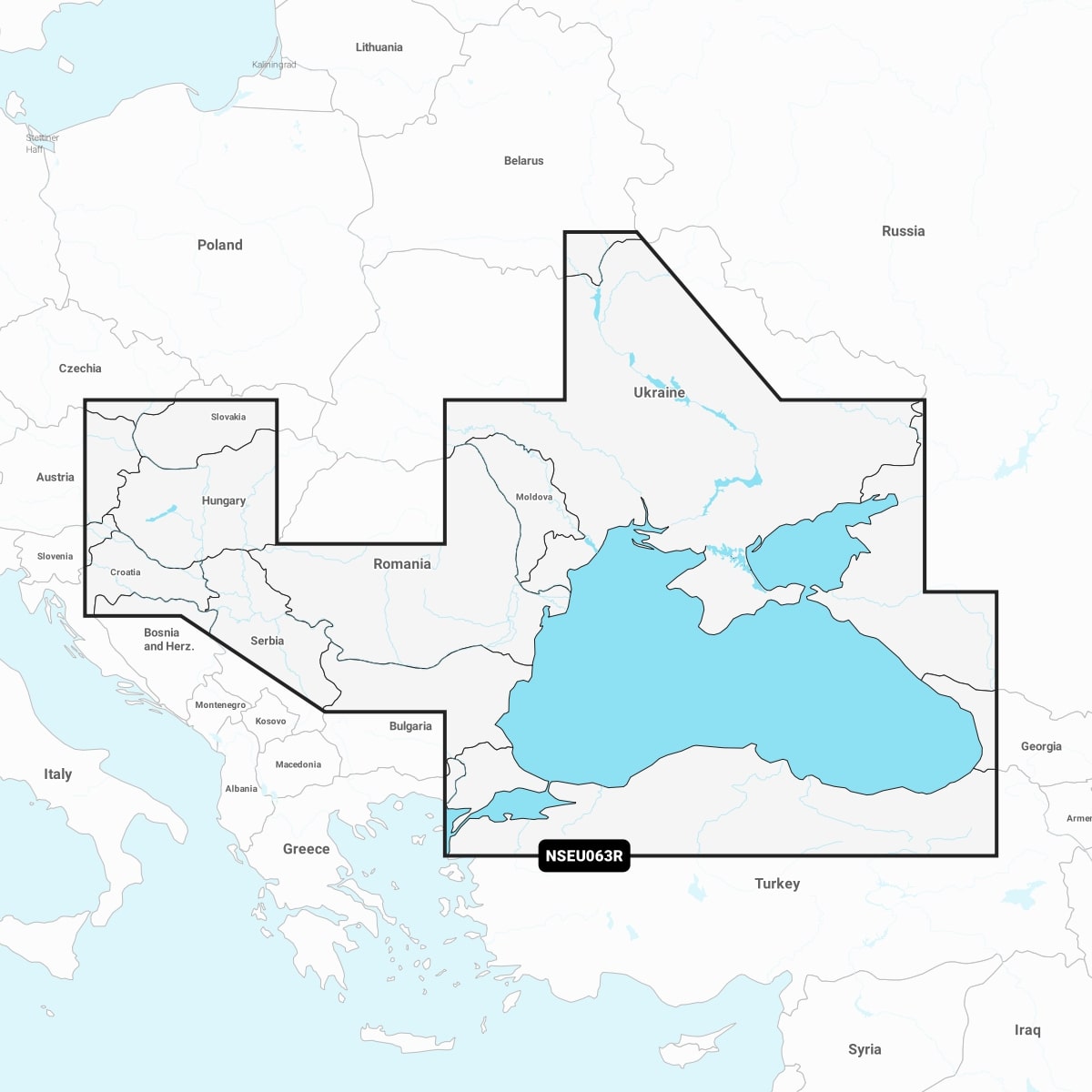
Detailed coverage of the Dardanelles, the Sea of Marmara, the Bosporus Strait, the Black Sea, the Dnieper River to the Belarus/Ukrainian border, the Bug River to Nikolayev, the Kuban River to Krasnodar, the Danube River from its Vienna to its delta, the Sava River, the Danube – Black Sea Canal, Lake Balaton, Lake Ferto, the Tisa River to Lake Tisza and the Sea of Azov. Detailed coverage includes Varna, Constanta, Odessa, Nikolayev, Sevastopol, Mariupol, Taganrog, Temryuk, Novorossiysk, Batumi, Hopa, Samsun, Eregli, Istanbul and Canakkale.
IT’S A WHOLE NEW LOOK ON YOUR CHARTPLOTTER
Featuring vibrant colours, a streamlined interface, and combined coastal/inland content with a popular Navionics® style colour palette, Garmin Navionics+ cartography makes it easy to plot your course with the world’s No. 1 name in marine mapping