
Description
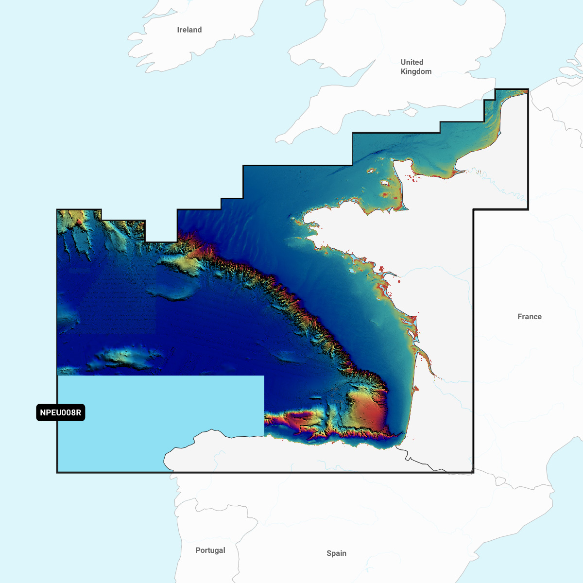
Navionics Platinum+™ – NPEU008R | microSD™/SD™
Coastal coverage of the Atlantic coast of Europe from Dunkirk, France to A Coruna, Spain including the Channel Islands and the ports of Le Havre, Brest, Nantes, Saint-Nazaire and Bordeaux in France and Bilbao and Gijon in Spain.
INTEGRATED MAPPING FOR A WIDE RANGE OF CHARTPLOTTERS
A comprehensive, all-in-one solution, Navionics+ charts and maps combine clear, reliable coastal/inland content with advanced guidance features and compatibility with a wide range of chartplotter brands.
![]()
Navigate with our best offshore and inland lake coverage for your compatible chartplotter1.
![]()
See it your way. Customise your view with various chart layers and overlay combinations.
![]()
With your included 1-year subscription, access daily updates via the Navionics® chart installer software.
![]()
Advanced route guidance technology2 lets you navigate with suggested dock-to-dock routings.
![]()
Selectable map options let you highlight shallow areas, adjust contour density or select a fishing range.
![]()
Save money — while continuing to access daily updates plus new content downloads — by renewing your subscription3.