
Description
Navionics Platinum+™ – NPEU081R | microSD™/SD™
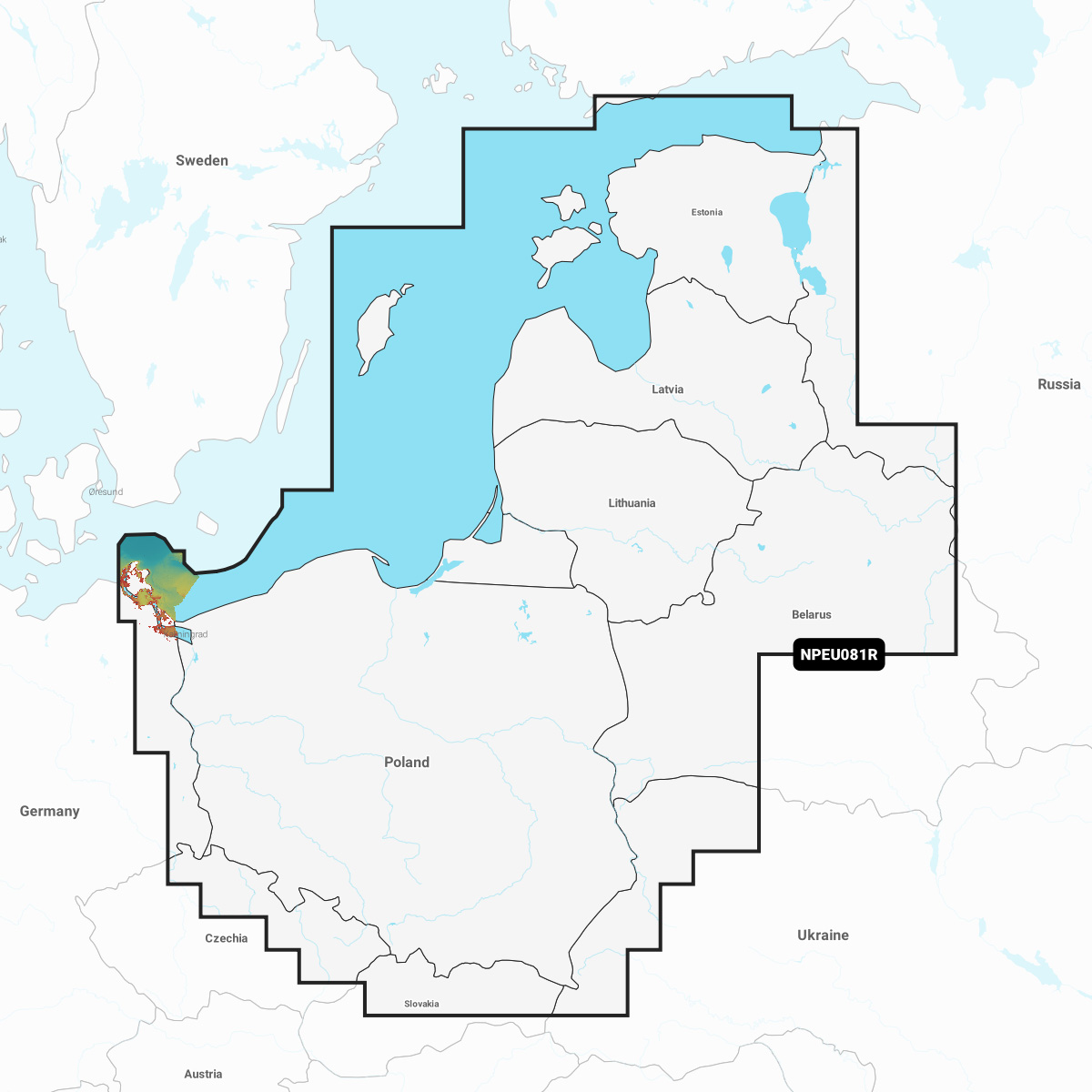
Coastal coverage of the Baltic Sea coasts of Poland, Russia, Lithuania, Latvia and Estonia from the German border to Narva-Jõesuu, EE and the lakes and rivers of Poland, Belarus and the Baltic States. Coverage includes the Gulf of Riga, the Szczecin, Vistula and Kurshskiy Lagoons, the islands of Gotland, Saaremaa and Hiiumaa, the Oder, Vistula, Bug, Neman, Emajõgi and Daugava Rivers, Lakes Peipus, Pihkva and Vörtsjäve, the Masurian District Lakes including Lake Jeziorak, Lake Łańskie and Lake Śniardwy and Lakes Snudy/Strusto, Miastra, Batorino, Lukomshoye and Selyava in Belarus. Ports include Tallinn, Estonia; Riga, Latvia; Gydnia and Gdansk, Poland and Kaliningrad, Russia.
INTEGRATED MAPPING FOR A WIDE RANGE OF CHARTPLOTTERS
A comprehensive, all-in-one solution, Navionics+ charts and maps combine clear, reliable coastal/inland content with advanced guidance features and compatibility with a wide range of chartplotter brands.
![]()
Navigate with our best offshore and inland lake coverage for your compatible chartplotter1.
![]()
See it your way. Customise your view with various chart layers and overlay combinations.
![]()
With your included 1-year subscription, access daily updates via the Navionics® chart installer software.
![]()
Advanced route guidance technology2 lets you navigate with suggested dock-to-dock routings.
![]()
Selectable map options let you highlight shallow areas, adjust contour density or select a fishing range.
![]()
Save money — while continuing to access daily updates plus new content downloads — by renewing your subscription3.